The Coastal Bays Fisheries Investigation is funded by a US Fish and Wildlife Service Sport Fish Restoration grant and is comprised of three activities:
- Trawl and Beach Seine Survey;
- Offshore Trawl Survey; and
- Submerged Aquatic Vegetation Habitat Survey
Trawl and Beach Seine Survey
 This survey was developed to characterize fishes and their abundances in Maryland's Coastal Bays, facilitate management decisions, and protect finfish habitats. The Coastal Fisheries Program has conducted the Trawl and Beach Seine Survey in Maryland's Coastal Bays since 1972, sampling with a standardized protocol since 1989. These gears target finfish although bycatch of crustaceans, mollusks, sponges, and macroalgae are common. Over 130 adult and juvenile species of fishes, 26 mollusks, and 11 macroalgae have been collected since 1972.
This survey was designed to meet the following three objectives:
- Characterize the stocks and estimate relative abundance of juvenile and adult marine and estuarine species in the Coastal Bays and near-shore Atlantic Ocean.
- Develop annual indices of age and length, specific relative abundance and other needed information necessary to assist in the management of regional and coastal fish stocks.
- Delineate and monitor areas of high value as spawning, nursery and/or forage locations for finfish in order to protect against habitat loss or degradation.
Data from this survey are used in state and federal compliance reports, stock assessments, and university studies.
Sample Area and Intensity
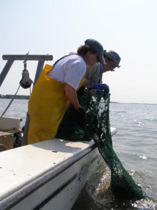 Trawl sampling is conducted at 20 fixed sites throughout Maryland's Coastal Bays on a monthly basis from April through October. With the exception of June and September, samples are taken beginning the third week of the month. Occasionally, weather or mechanical issues require sampling into the next month. Sampling begins in the second week in June and September in order to allow enough time to incorporate beach seine collections.
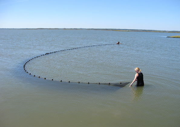
Seining samples the shallow regions of the Coastal Bays frequented by juvenile fishes. Shore beach seine sampling is conducted at 19 fixed sites beginning in the second week of June and September. A 30.5 m X 1.8 m X 6.4 mm mesh (100 ft X 6 ft X 0.25 in. mesh) bag seine is used at 18 fixed sites in depths less than 1.1 m (3.5 ft.) along the shoreline. However, some sites necessitated varying this routine to fit the available area and depth. A 15.24 m (50 foot) version of the previously described net is used at site S019 due to it is restricted sampling area. GPS coordinates are taken at the start and stop points as well as an estimated percent of net open.
Sample Equipment
Trawl samples are collected using a 16 ft. semi-balloon trawl rigged in the following manner:
The net is made of nylon netting of the following size mesh and thread:
Fish Abundance Indices
One of the products of the survey is indices of abundance for several species of interest that are collected by the survey. Indices of relative abundance are presented as Geometric Mean Catch per Haul. The Geometric Mean has been adopted by the Atlantic States Marine Fisheries Commission as the preferred index of relative abundance. The Geometric Mean is a statistical way of handling the data that is more precise than the Arithmetic Mean Catch per Haul because it is not as sensitive to a single large sample value.
Data Request procedure
Coastal Bays Fisheries Investigation data can be requested from Craig Weedon (craig.weedon@maryland.gov).
Submerged Aquatic Vegetation Habitat Survey
There are two submerged aquatic vegetation species found in Maryland’s coastal bays: eelgrass (Zostera marina) and widgeon grass (Ruppia maritima). Many species depend upon grass beds for protection and feeding at some point in their life cycle. With submerged aquatic vegetation playing such a significant role in the life cycle of many fishes and its susceptibility to anthropogenic perturbations, the characterization of fisheries resources within these areas is important. Therefore, the department began sampling fishes in submerged aquatic vegetation using a beach seine in 2012. This survey was designed to meet the following two objectives:
- characterize submerged aquatic vegetation habitat usage by fish assemblages in Maryland’s coastal bays; and
- incorporate the results of this study to better guide management decisions.
